Passwort verloren? Neuer Benutzer? Registrieren
Genieße und Trage etwas bei!
| Finde die besten Spots |
|
|
 Uruguay
Südamerika
Ort: Southern South America, bordering the South Atlantic Ocean, between Argentina and Brazil
Geografische Koordinaten: 33° 0' S, 56° 0' W
Küste km: 660 km km
Klima: warm temperate; freezing temperatures almost unknown
Gelände: mostly rolling plains and low hills; fertile coastal lowland
Höhe: lowest point: Atlantic Ocean 0 m
highest point: Cerro Catedral 514 m
Natürliche Gefahren: seasonally high winds (the pampero is a chilly and occasional violent wind that blows north from the Argentine pampas), droughts, floods; because of the absence of mountains, which act as weather barriers, all locations are particularly vulnerable to rapid changes from weather fronts
Währung: Uruguayan peso (UYU)
Bevölkerung: 3,477,778 (July 2008 est.)
Sprachen: Spanish, Portunol, or Brazilero (Portuguese-Spanish mix on the Brazilian frontier)
Hauptstadt: Montevideo
Bereiche: 19 departments: Artigas, Canelones, Cerro Largo, Colonia, Durazno, Flores, Florida, Lavalleja, Maldonado, Montevideo, Paysandu, Rio Negro, Rivera, Rocha, Salto, San Jose, Soriano, Tacuarembo, Treinta y Tres
Möchtest du Informationen über Uruguay hinzufügen? Lass es uns wissen ...
Dies ist eine interaktive Karte! Verwende die Steuerelemente zum schwenken und zoomen.
- Kite Sessions (0)
- ausflüge (0)
- Fotos (3)
- Videos (0)
- Teile
- Favorit
-
Deine Favouriten und Zukünftige-Spots-Listen
Spots
| Spots (3) | Qualität | Erfahrung | Typ | Einrichtungen | ||
|---|---|---|---|---|---|---|
| 31 De La Brava | - / - | Fortgeschritten | Offener Ozean | 


|
||
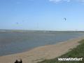
| Laguna Garzon | 2 / - | Jeder | Lagune | |||
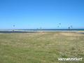
| Laguna Jose Ignacio | 1 / - | Jeder | Lagune |

 Kommentare
Errors, Feedback
Wenn du neue Information hinzufügen möchtest, oder Fehler in diesem Land gefunden hast, Schicken Sie uns Ihr Feedback.