Passwort verloren? Neuer Benutzer? Registrieren
Genieße und Trage etwas bei!
| Finde die besten Spots |
|
|
 Venezuela
Südamerika
Ort: Northern South America, bordering the Caribbean Sea and the North Atlantic Ocean, between Colombia and Guyana
Geografische Koordinaten: 8° 0' N, 66° 0' W
Küste km: 2,800 km km
Klima: tropical; hot, humid; more moderate in highlands
Gelände: Andes Mountains and Maracaibo Lowlands in northwest; central plains (llanos); Guiana Highlands in southeast
Höhe: lowest point: Caribbean Sea 0 m
highest point: Pico Bolivar (La Columna) 5,007 m
Natürliche Gefahren: subject to floods, rockslides, mudslides; periodic droughts
Währung: bolivar (VEB)
Bevölkerung: 26,023,528 (July 2007 est.)
Sprachen: Spanish (official), numerous indigenous dialects
Hauptstadt: Caracas
Bereiche: 23 states, 1 capital district*, and 1 federal dependency**: Amazonas, Anzoategui, Apure, Aragua, Barinas, Bolivar, Carabobo, Cojedes, Delta Amacuro, Dependencias Federales**, Distrito Federal*, Falcon, Guarico, Lara, Merida, Miranda, Monagas, Nueva Esparta, Portuguesa, Sucre, Tachira, Trujillo, Vargas, Yaracuy, Zulia
note: the federal dependency consists of 11 federally controlled island groups with a total of 72 individual islands
Möchtest du Informationen über Venezuela hinzufügen? Lass es uns wissen ...
Dies ist eine interaktive Karte! Verwende die Steuerelemente zum schwenken und zoomen.
- Kite Sessions (0)
- ausflüge (0)
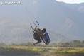
- Fotos (17)
- Videos (0)
- Teile
- Favorit
-
Deine Favouriten und Zukünftige-Spots-Listen
Deine bevorzugte Zone ist nicht aufgeführt? Neue Zone hinzufügen
Zonen
| Zonen (4) | Spots | Sub Zonen |
|---|---|---|
| Bolivar | 1 | 0 |
| Carabobo | 1 | 0 |
| Falcon | 2 | 0 |
| Nueva Esparta | 1 | 0 |
Spots
| Spots (1) | Qualität | Erfahrung | Typ | Einrichtungen | ||
|---|---|---|---|---|---|---|
| Los Roques | 4 / - | Jeder | Lagune |


 Kommentare
Errors, Feedback
Wenn du neue Information hinzufügen möchtest, oder Fehler in diesem Land gefunden hast, Schicken Sie uns Ihr Feedback.